Software, data and AI that work every day.
Location Science is a software and data company from Upper Bavaria. We digitalise processes, introduce AI and make geodata usable, for public authorities and for companies. With StoryMapp we have a product of our own that shows how we work.
Does this sound familiar?
- Data sits in many systems, does not fit together and has to be normalised first.
- Management wants AI. Nobody knows where it adds value and what is already possible today.
- Geodata exists, but nobody brings it into an app. Important projects stay on the shelf.
- Processes cost time because data is entered and checked by hand.
- The tools you bought do not fit your own problems.
That is exactly where we start: with interfaces, automation and software that fits your task.
Focus areas
-
Digitalise processes
Paper, email and spreadsheets become an application connected to your existing systems. Interfaces and automation replace manual work and error checking.
-
Introduce AI
We check where AI already adds value in your organisation, build it in there and measure the result. Where it does not fit, we say so.
-
Make geodata usable
Data becomes maps, apps and services. Spatial databases, normalisation, OGC interfaces, offline on the device or public in the app.
- Operations. We operate what we build: deployment, monitoring, DevOps.
- Open data. We build on open data and contribute to OpenStreetMap.
- Privacy by design. GDPR from day one, developed and operated in Germany.
- Three founders. No intermediaries. You talk to the people who write the code.
Open data shows the ways. Context decides which one is right.
What we are working on
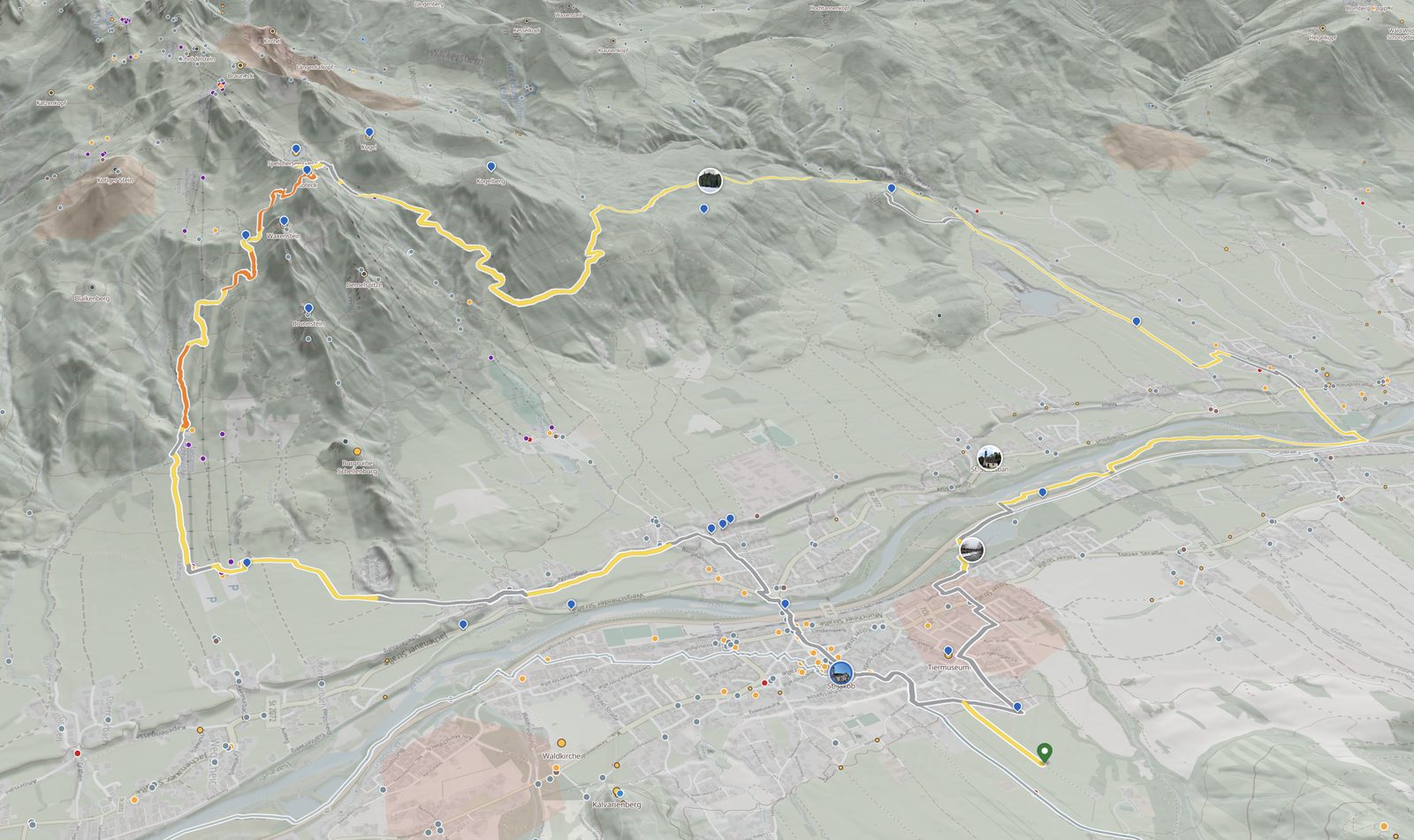
Four projects that show how we bring data, software and AI together. Two of them are still in development, and we say so.
-
 In development
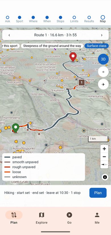
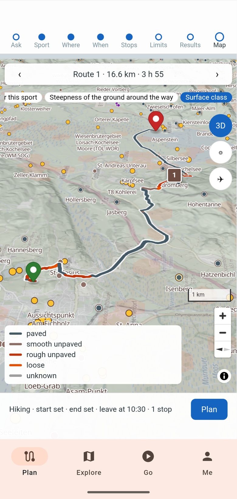
Tour planner that builds the tour for the day
Most tour portals show a database of ready-made tours. Our planner creates the tour for the user and the day. It combines weather, warnings and closures with fitness, time budget and preferences, and with trail surface, gradient, shade and places to rest or eat.
The result is a route that fits, instead of a list to search through.
-
 In development
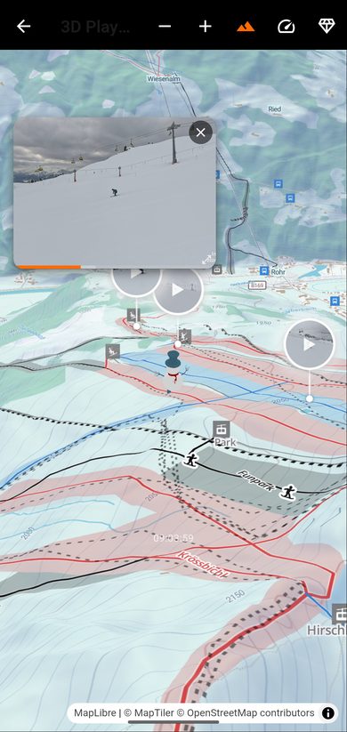
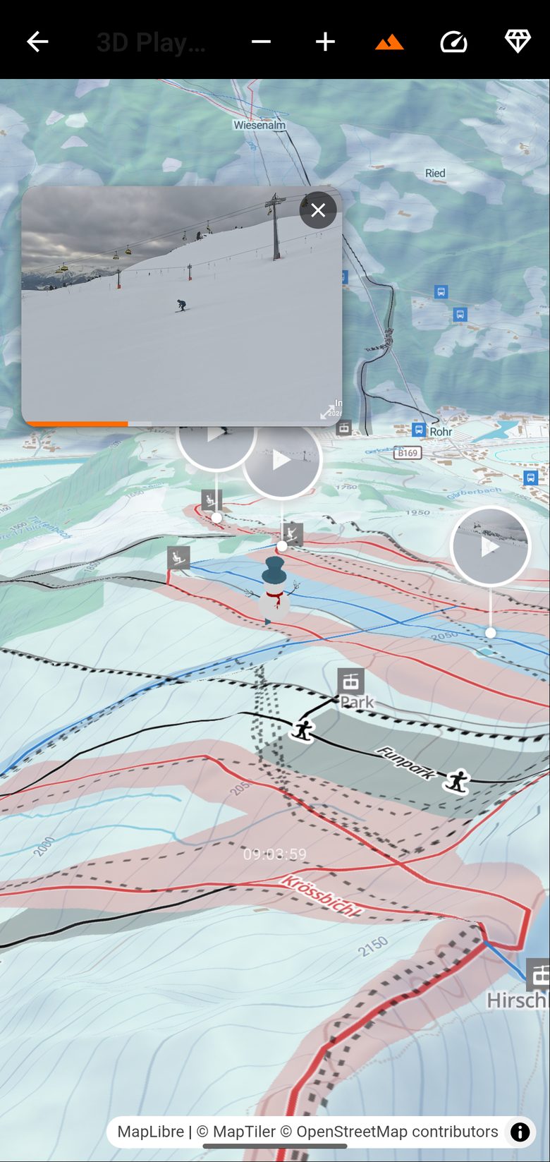
SkiApp: the ski day, measured and shared
The app records the skier's statistics and health data and links them to the geography of the ski area. Photos and videos are embedded in a 3D replay of the run that can be shared with friends and followers.
Behind it: a terrain model, piste data, on-device positioning, and a snow and weather report from several sources.
-
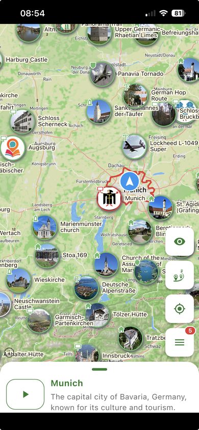 In operation
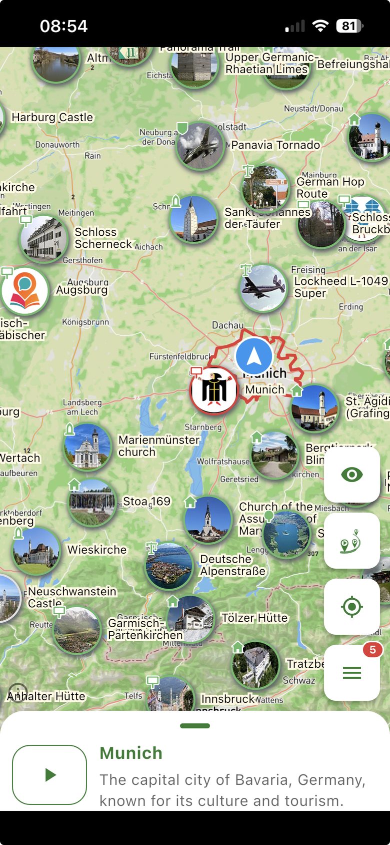
StoryMapp: stories about places, worldwide
Our own product, free for iOS and Android. More than 8 million stories in six languages, worldwide coverage, a monthly update cycle, users in 58 countries. Partner: the artists' project Art Hop Silver Lake in Los Angeles.
The data pipeline behind it runs without manual work, and the users' location never leaves the device. About StoryMapp →
Three founders. Engineers first.
We come from geography and geoinformatics, cartography and information and communication technology. We have worked in start-ups as well as in large companies, often on systems where mistakes are expensive.
- Geography and geoinformatics
- Cartography
- Information and communication technology
Working experience: public-safety organisations (BOS), defence engineering, global car navigation, DevOps.
Tobias Neumann
Managing partner
Studied geography (B.Sc.) and geoinformatics (M.Sc.) and has worked with spatial information ever since. Experience from equipping emergency control centres, developing air-defence systems and global car-navigation projects, including for TomTom. Most recently research on open geodata at a world-leading technology company. Builds and optimises spatial databases, geodata infrastructures and data compilers that turn raw data into deliverable map formats, as well as front ends for map display. A particular focus is proofs of concept that make new ideas quick to test, and agentic systems for autonomous operation.

Kangle Li, PhD
Founder
PhD in information and communication technology, with research focused on designing and implementing digital signal processing algorithms. Research at several universities, including Munich University of Applied Sciences (Hochschule München). In-depth expertise in pattern recognition, machine learning and deep learning, applied to object detection, classification and natural language processing. Builds applications on large language models end to end, from vector databases, frameworks and model APIs to deployment and fine-tuning. A particular focus is the control layer around the model that reduces hallucinations and keeps output quality reliable.
Working with us
Three ways to work with us. Each begins with an email, and one of the founders always answers.
- Daily rate €900 net, for development and consulting alike.
- Fixed price for clearly specified projects under a works contract, based on a jointly written specification.
- First conversation free of charge, remote or at your office.
-
Software, maps and data, built for you
We develop your application, your data pipeline or your AI solution, from the idea to operation. For the public sector and companies.
Start a conversation -
Consulting
Digitalisation, software engineering, AI adoption and spatial data management. We tell you what works and what does not.
Ask for a consultation -
Your tours on StoryMapp
For museums, city marketing, tourism, zoos and the arts: your tours appear on the map, in every visitor's language.
Share your tours